2026
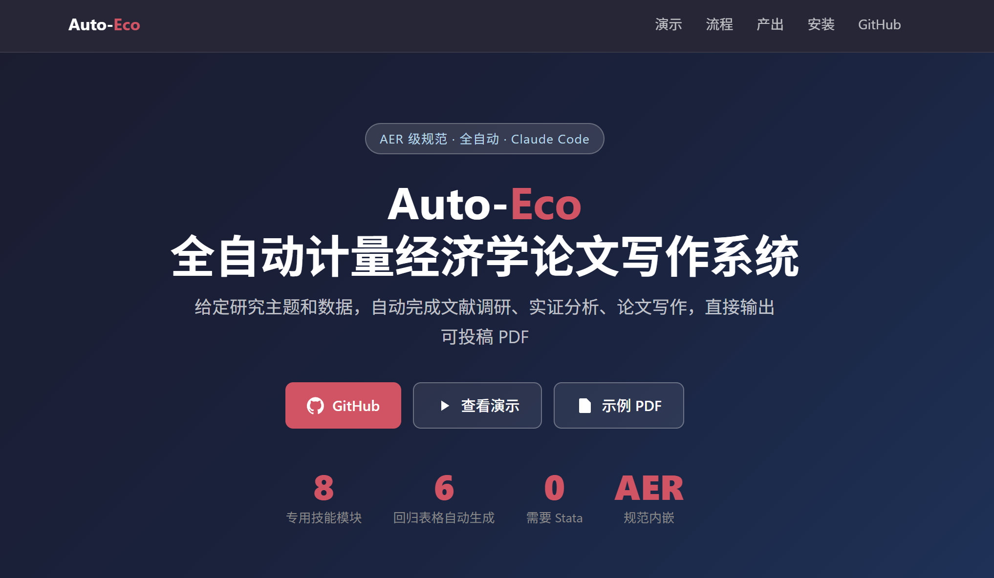
Auto-Eco — Automated Econometrics Paper Writing System
Auto-Eco is a fully automated pipeline for writing publication-ready econometrics papers. Given a research topic and dataset, it automatically completes literature review, causal identification, empirical analysis (CS-DiD, TWFE, IV), and LaTeX compilation — outputting a submission-ready PDF. Built as Claude Code skills with AER-standard specifications embedded. No Stata required.
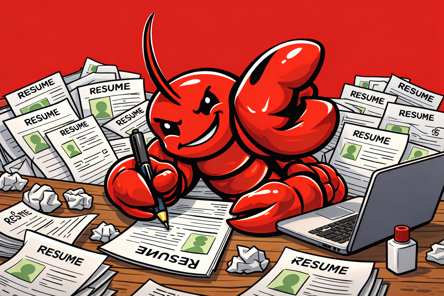
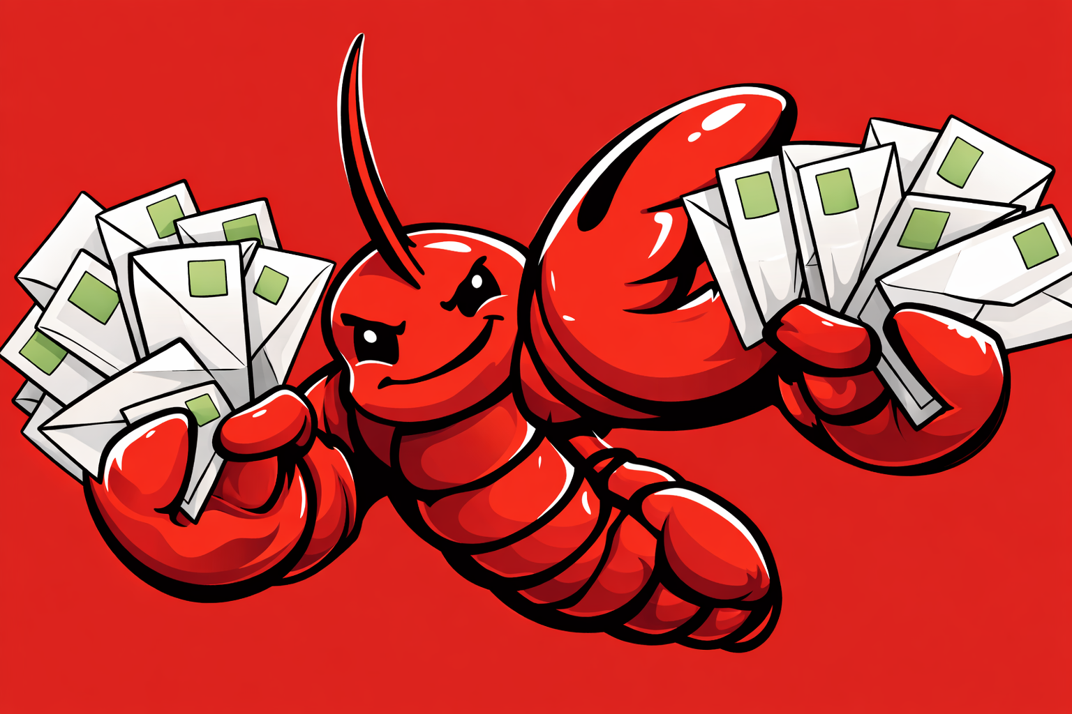
AutoApplyClaw — Apply Smarter, Not Harder
AutoApplyClaw is a full-stack job application automation platform. Search jobs from LinkedIn & Indeed, generate AI-tailored resumes and cover letters for each position using Claude, then auto-fill every application form with the Chrome extension — including open-ended questions answered from your actual CV. Built with React, FastAPI, Claude API, Tectonic (LaTeX compiler), and a Chrome Manifest V3 extension. Live at autoapplyclaw.com.
OfferOpenClaw — AI-Powered PhD Faculty Outreach Automation Agent
OfferOpenClaw is an email-triggered automation agent that streamlines PhD faculty outreach. Simply email your CV and the system automatically scrapes faculty pages, analyzes research alignment via Semantic Scholar, rates compatibility (0–10), and generates personalized cold emails for top matches — all results delivered back to your inbox. Built with Claude API, BeautifulSoup, Gmail IMAP/SMTP, and PyMuPDF.
2025
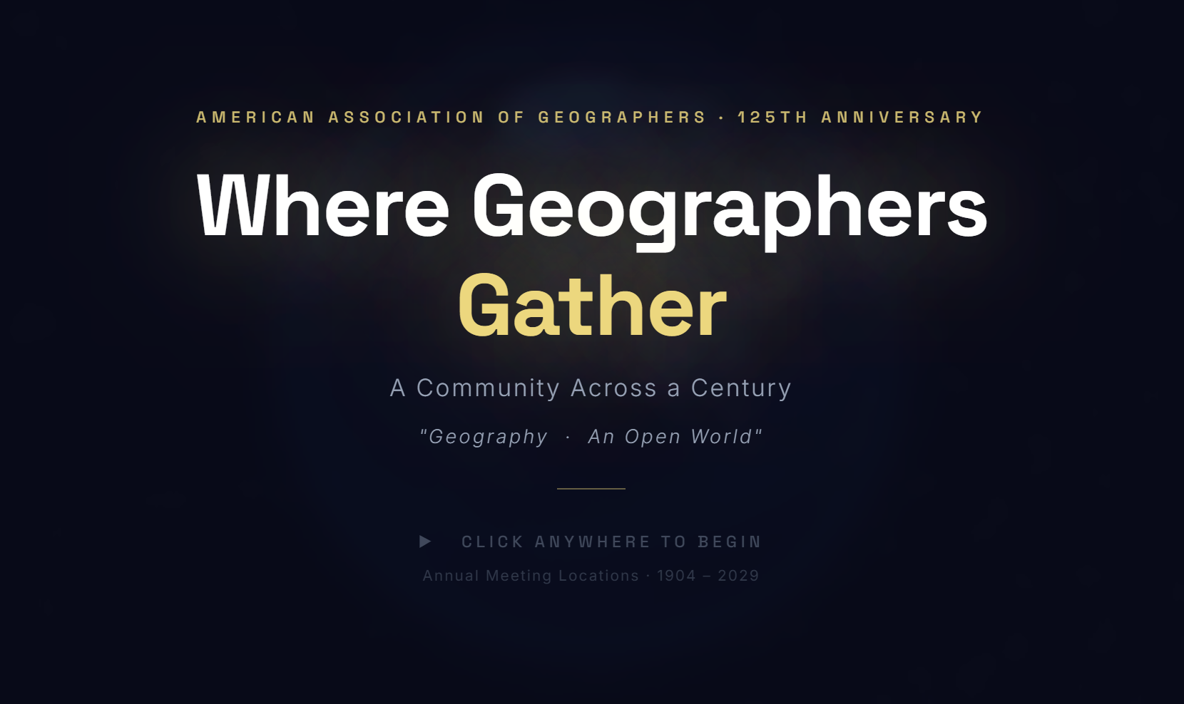
Where Geographers Gather — AAG 125th Anniversary Annual Meeting Globe
An interactive 3D globe tracing every AAG Annual Meeting location from 1904 to 2029, celebrating the association's 125th anniversary. Built with globe.gl and Three.js, it animates great-circle arcs between consecutive host cities, displays attendance trends, presidential history, and milestone annotations across 125 years of geography's premier gathering. Features a live leaderboard of top host cities, era-colored point markers, and background music.
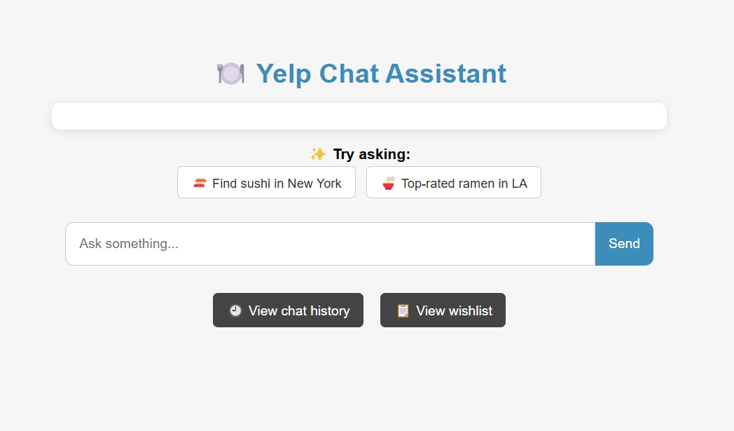
Yelp ChatDB — Natural Language Restaurant Search System
Yelp ChatDB is a full-stack chatbot application that enables users to search for restaurants and manage personal wishlists using natural language queries. The backend leverages GPT for intent parsing, MongoDB for caching and data storage, and the Yelp Fusion API for real-time restaurant data. The frontend is a lightweight React-like interface that supports conversational search.
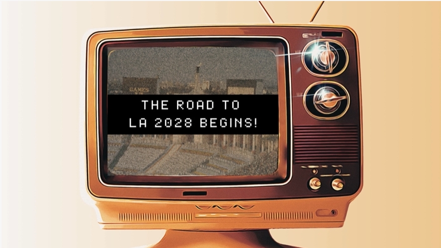
Transit Triumph or Traffic Tangle? Evaluating Los Angeles’ Transit Equity for the 2028 Car-Free Olympics
This project assesses the feasibility of a “car-free” 2028 Los Angeles Olympics, where all venue access relies on public transport. Using the Two-Step Floating Catchment Area (2SFCA) method, it analyzes accessibility, evaluating infrastructure, population density, and socioeconomic factors. By mapping the accessibility index (AI) across neighborhoods, the study examines whether the transit network can support the event. Future directions explore equity in access and the long-term transportation legacy of the Games.
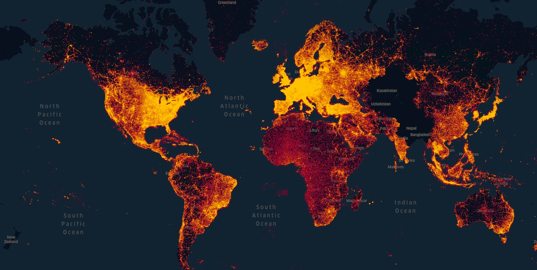
Foursquare Open Source Places - POI Data Processing
Foursquare Open Source Places (FSQ OS Places) is a high-quality, open POI (Points of Interest) dataset released by Foursquare, containing over 104 million POIs worldwide. While platforms like OpenStreetMap (OSM) and Overture Maps aim to improve open POI coverage, FSQ OS Places provides a more extensive and precise dataset. This repository provides a step-by-step guide on downloading POI data and converting it from GeoJSON to Shapefile (SHP) for use in ArcGIS Pro, QGIS, and other GIS applications.
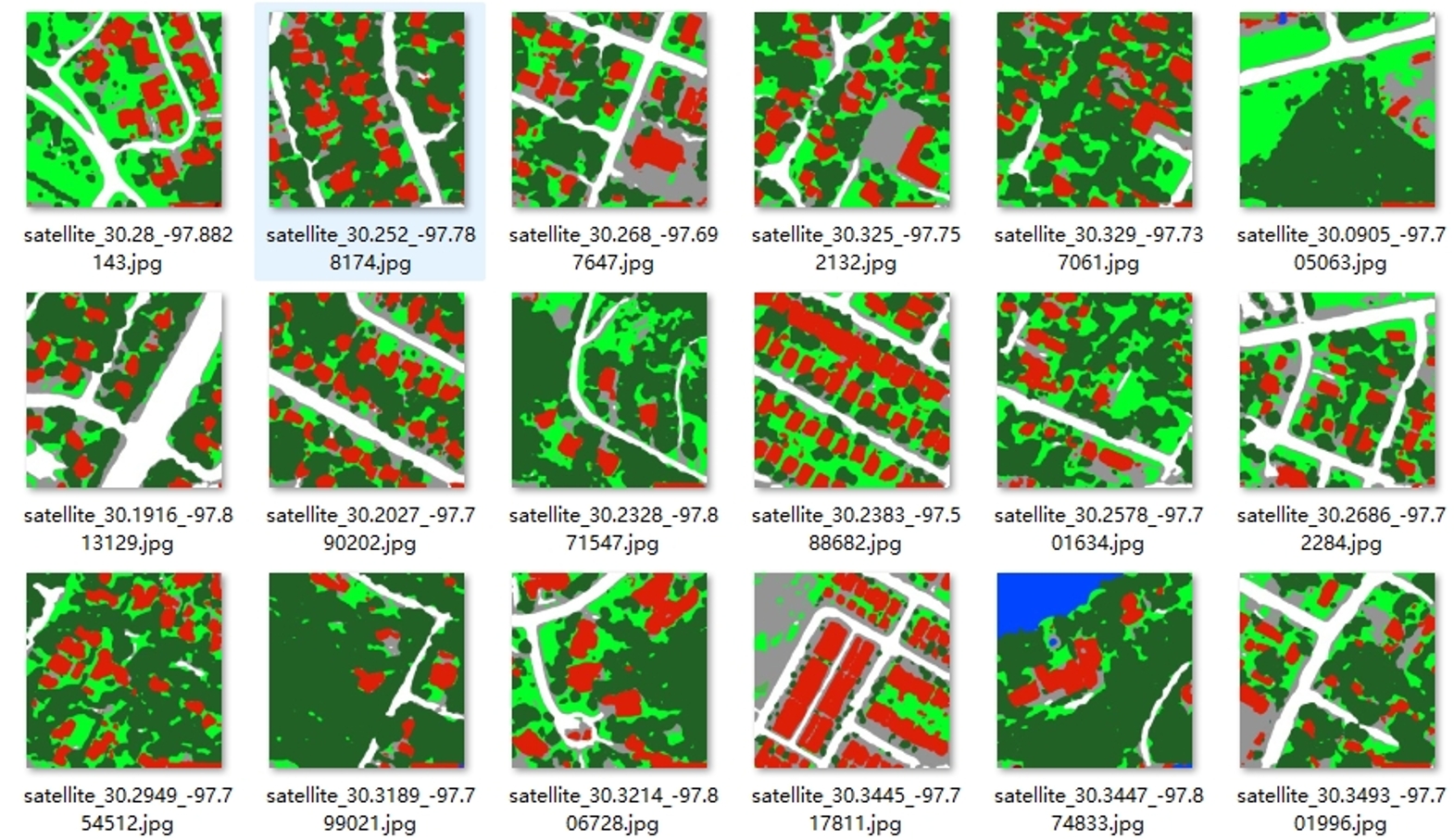
DeepLabV3Plus for Satellite Image Segmentation - OpenEarthMap
This repository contains the computer code that supported the publication of our research: "Multi-source Tri-environmental Conceptual Framework for Fire Impact Analysis" (under review in Urban Informatics). This package helps researchers quickly generate high-resolution population density layers using dasymetric mapping, a sophisticated geospatial technique that leverages detailed land cover data to distribute demographic data across predefined spatial units, such as census blocks.
2024
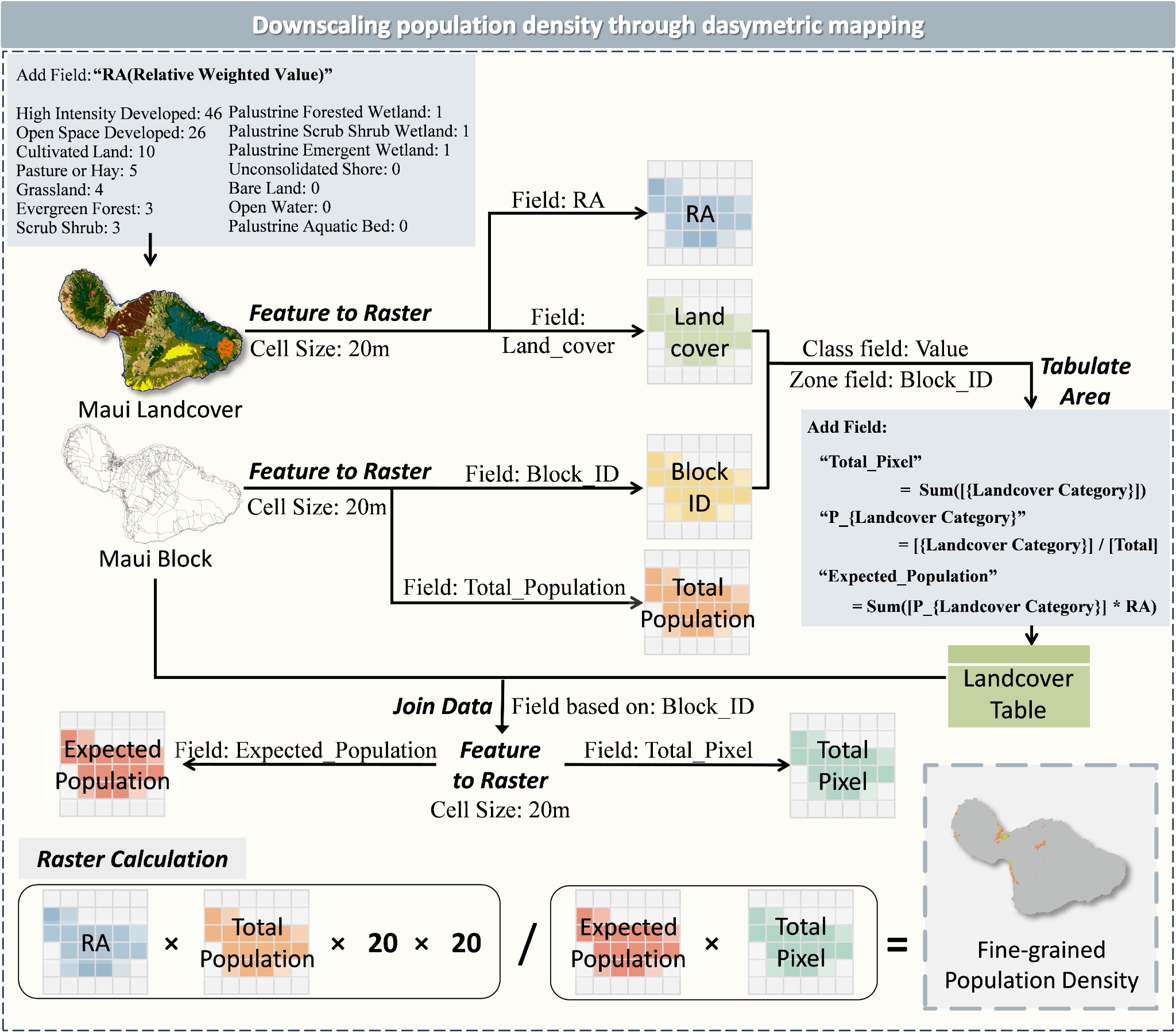
Dasymetric Mapper: High-Resolution Population Density Layer Generation
This repository contains the computer code that supported the publication of our research: "Multi-source Tri-environmental Conceptual Framework for Fire Impact Analysis" (under review in Urban Informatics). This package helps researchers quickly generate high-resolution population density layers using dasymetric mapping, a sophisticated geospatial technique that leverages detailed land cover data to distribute demographic data across predefined spatial units, such as census blocks.
Geospatial Analysis of Socioeconomic Status and Restaurant Distribution in LA
This data science project aims to perform a geospatial analysis of socioeconomic status and its impact on restaurant distribution across Los Angeles County. By leveraging diverse web sources, this study examines the correlation between socioeconomic factors — like education and income — and the variety of restaurants available in different areas. The goal is to understand how these elements influence food service diversity, contributing valuable insights into urban planning and social equity.