Jasper Zongrong Li
Logo Ph.D. in Geographic Information Systems

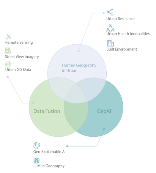
I'm an interdisciplinary researcher interested in applying GeoAI methods to advance urban science, understand human-environment interactions in 3D urban space, and leverage 3D Mesh Model, street view and remote sensing for urban perception and analysis. Research Interests

I am currently a Ph.D. student in Geographic Information Systems at Texas A&M University, advised by Prof. Lei Zou in the TAMU GEAR Lab. I previously earned my Master of Science in Spatial Data Science at the University of Southern California, advised by Prof. Siqin Wang and Prof. Yi Qi. I hold a Bachelor of Economics in Finance from Nanjing Audit University.

Previously, I was also a Research Assistant at HKUST(GZ), working in the AI4City Lab with Prof. Wufan Zhao. Before that, I worked as a Data Science Intern at City of Hope under the supervision of Dr. Jay Yang and as a Research Assistant at The Hong Kong Polytechnic University, advised by Prof. Zhiwei Li.

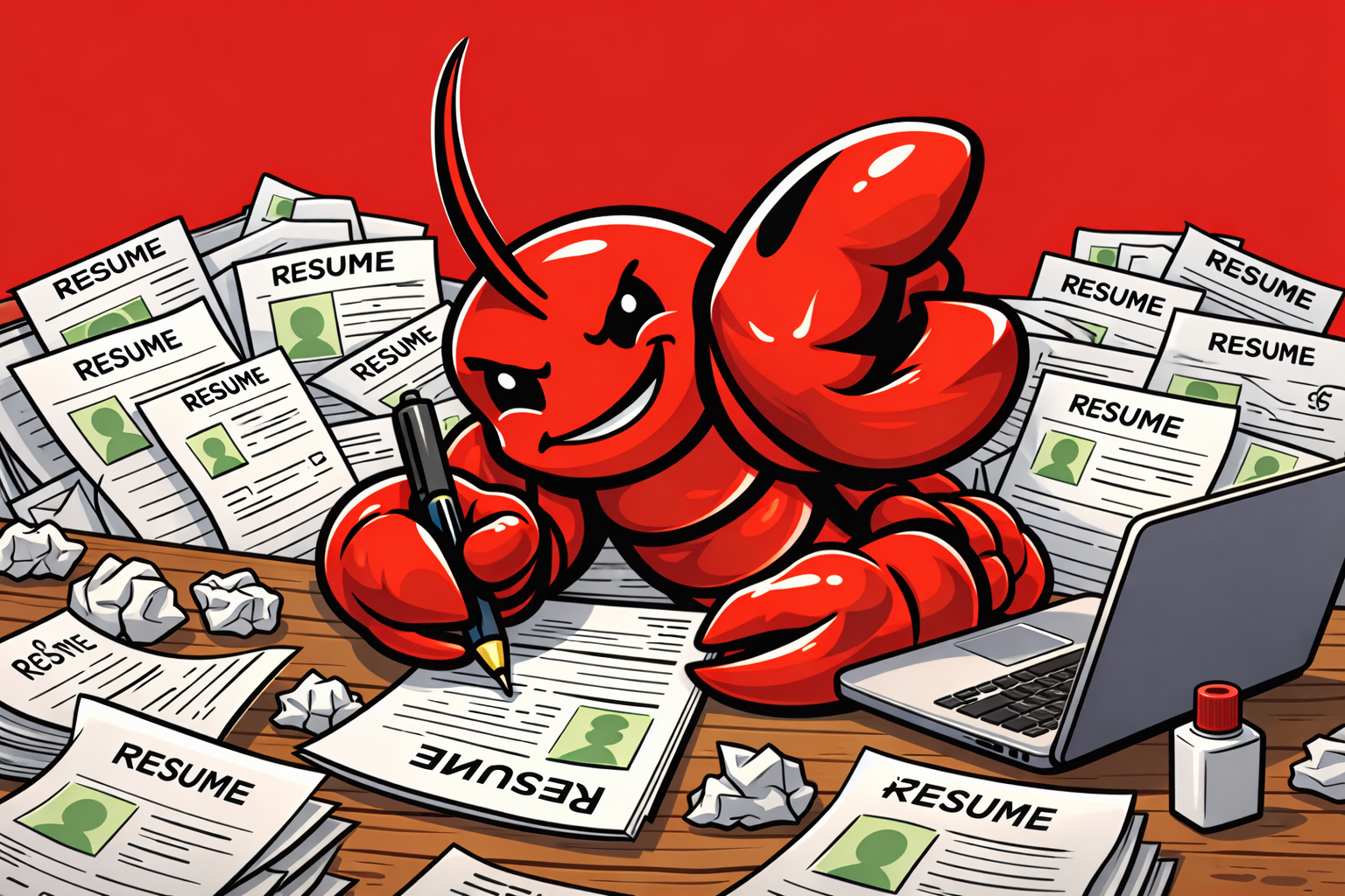
I also share my journey as a study-abroad influencer on RedNote (Xiaohongshu) with 30k followers.

I am looking for collaborators and interns interested in GeoAI, Spatial Analysis, and their applications in urban science and human-environment interaction in 3D urban space. My goal is to develop novel tools, algorithms, and methodologies to empower future researchers in exploring Urban Science and understanding the dynamic relationship between humans and their environments. If you are interested in collaborating, please feel free to reach out via email or WeChat.

Curriculum Vitae

Education
  • Texas A&M University
    Texas A&M University
    Ph.D. in Geographic Information Systems
    Aug. 2025 - Present
  • University of Southern California
    University of Southern California
    M.S. in Spatial Data Science
    Aug. 2023 - May. 2025
  • Nanjing Audit University
    Nanjing Audit University
    B.A. in Economics, Finance
    Sep. 2018 - Jul. 2022
Honors & Awards
  • AAG International Geographic Information Fund ($1200)
    Feb. 2026
  • AAG AGSG Annual Meeting Award ($202)
    Feb. 2026
  • TAMU Dean's Doctoral Fellowship
    Aug. 2025
  • 2025 AAG GISS Student Paper Competition Honorable Mention
    Mar. 2025
  • 2025 EIP Student of the Year Award
    Mar. 2025
  • Most Suitably Applied Analysis Methodology Award
    Feb. 2025
  • Bronze medal in Kaggle's Child Mind Institute - Detect Sleep States
    Jan. 2024
  • Outstanding Graduate Award
    Jun. 2022
  • Provincial Champion of The World Mandarin Debating Championship
    Sep. 2020
Experience
  • The Hong Kong University of Science and Technology (Guangzhou)
    The Hong Kong University of Science and Technology (Guangzhou)
    Research Assistant - AI4City Lab
    Aug. 2024 - Aug.2025
  • Harvard University
    Harvard University
    Research Assistant - Spatial Data Lab
    May. 2024 - Sep. 2024
  • City of Hope
    City of Hope
    Data Science Intern
    Feb. 2024 - May. 2024
  • The Hong Kong Polytechnic University
    The Hong Kong Polytechnic University
    Research Assistant
    Sep. 2023 - May. 2024
  • NetEase Youdao
    NetEase Youdao
    Data Analyst Intern
    Jan. 2023 - Apr. 2023
News
2026
Released OfferOpenClaw, an email-triggered AI agent that automates PhD faculty outreach — scrapes faculty pages, rates research alignment, and generates personalized cold emails from your CV. Check it out
Mar 11
Won the 2026 AAG Applied Geography Specialty Group (AGSG) Annual Meeting Award ($202).
Feb 01
Won the 2026 AAG International Geographic Information Fund ($1,200).
Feb 01
2025
Our BuildingView paper has been accepted to ACM SpatialDI 2025.
Mar 27
Won "Honorable Mention" in 2025 AAG GISS Student Paper Competition. Details
Mar 25
Won "2025 EIP Student of the Year Award", with name permanently inscribed on a USC Spatial Sciences Institute plaque. Details
Mar 18
Won the "Most Suitably Applied Analysis Methodology" award at the 2025 LA Geospatial Summit Story Map
Feb 28
Selected Publications (view all )
Visual Access to Urban Greenery from Indoor Spaces: A 3D Window View Approach for Large U.S. Metropolitan Areas

Zongrong Li, Lei Zou# (# corresponding author)

Ongoing 2026

Visual Access to Urban Greenery from Indoor Spaces: A 3D Window View Approach for Large U.S. Metropolitan Areas

Zongrong Li, Lei Zou# (# corresponding author)

Ongoing 2026

Bridging Street View Coverage Disparities through Geographic Identity Preserving Generation from Satellite View

Zongrong Li, Fan Zhang, Shaoqiong Dai, Wufan Zhao# (# corresponding author)

Under Review, ISPRS Journal of Photo grammetry and Remote Sensing 2025

Bridging Street View Coverage Disparities through Geographic Identity Preserving Generation from Satellite View

Zongrong Li, Fan Zhang, Shaoqiong Dai, Wufan Zhao# (# corresponding author)

Under Review, ISPRS Journal of Photo grammetry and Remote Sensing 2025

Integrating Earth Observation Data Into the Tri-environmental Evaluation of the Economic Cost of Natural Disasters: A Case Study of 2025 LA Wildfire

Zongrong Li, Haiyang Li, Yifan Yang, Siqin Wang#, Yinxin Zhu (# corresponding author)

Under review, International Journal of Applied Earth Observation and Geoinformation(JAG) 2025

BuildingMultiView: Powering Multi-Scale Building Characterization with Large Language Models and Multi-Perspective Imagery

Zongrong Li, Yunlei Su, Filip Biljecki, Wufan Zhao# (# corresponding author)

Under review, International Journal of Applied Earth Observation and Geoinformation(JAG) 2025

BuildingMultiView: Powering Multi-Scale Building Characterization with Large Language Models and Multi-Perspective Imagery

Zongrong Li, Yunlei Su, Filip Biljecki, Wufan Zhao# (# corresponding author)

Under review, International Journal of Applied Earth Observation and Geoinformation(JAG) 2025

StreetviewLLM: Extracting Geographic Information Using a Chain-of-Thought Multimodal Large Language Model

Zongrong Li, Junhao Xu, Siqin Wang#, Yifan Wu, Haiyang Li (# corresponding author)

Under review, International Journal of Applied Earth Observation and Geoinformation(JAG) 2024

StreetviewLLM: Extracting Geographic Information Using a Chain-of-Thought Multimodal Large Language Model

Zongrong Li, Junhao Xu, Siqin Wang#, Yifan Wu, Haiyang Li (# corresponding author)

Under review, International Journal of Applied Earth Observation and Geoinformation(JAG) 2024

Multi-source tri-environmental conceptual framework for fire impact analysis

Zongrong Li, Qiluo Li, Haiyang Li, Siqin Wang#, Yi Qi# (# corresponding author)

Urban Informatics 2024

Multi-source tri-environmental conceptual framework for fire impact analysis

Zongrong Li, Qiluo Li, Haiyang Li, Siqin Wang#, Yi Qi# (# corresponding author)

Urban Informatics 2024

BuildingView: Constructing Urban Building Exteriors Databases with Street View Imagery and Multimodal Large Language Model

Zongrong Li, Yunlei Su, Wufan Zhao# (# corresponding author)

Accepted to ACM SpatialDI 2025

BuildingView: Constructing Urban Building Exteriors Databases with Street View Imagery and Multimodal Large Language Model

Zongrong Li, Yunlei Su, Wufan Zhao# (# corresponding author)

Accepted to ACM SpatialDI 2025

All publications
Selected Projects (view all )
OfferOpenClaw — AI-Powered PhD Faculty Outreach Automation Agent

OfferOpenClaw — AI-Powered PhD Faculty Outreach Automation Agent

OfferOpenClaw is an email-triggered automation agent that streamlines PhD faculty outreach. Simply email your CV and the system automatically scrapes faculty pages, analyzes research alignment via Semantic Scholar, rates compatibility (0–10), and generates personalized cold emails for top matches — all results delivered back to your inbox. Built with Claude API, BeautifulSoup, Gmail IMAP/SMTP, and PyMuPDF.

OfferOpenClaw — AI-Powered PhD Faculty Outreach Automation Agent

OfferOpenClaw — AI-Powered PhD Faculty Outreach Automation Agent

OfferOpenClaw is an email-triggered automation agent that streamlines PhD faculty outreach. Simply email your CV and the system automatically scrapes faculty pages, analyzes research alignment via Semantic Scholar, rates compatibility (0–10), and generates personalized cold emails for top matches — all results delivered back to your inbox. Built with Claude API, BeautifulSoup, Gmail IMAP/SMTP, and PyMuPDF.

Transit Triumph or Traffic Tangle? Evaluating Los Angeles’ Transit Equity for the 2028 Car-Free Olympics

Transit Triumph or Traffic Tangle? Evaluating Los Angeles’ Transit Equity for the 2028 Car-Free Olympics

This project assesses the feasibility of a “car-free” 2028 Los Angeles Olympics, where all venue access relies on public transport. Using the Two-Step Floating Catchment Area (2SFCA) method, it analyzes accessibility, evaluating infrastructure, population density, and socioeconomic factors. By mapping the accessibility index (AI) across neighborhoods, the study examines whether the transit network can support the event. Future directions explore equity in access and the long-term transportation legacy of the Games.

Transit Triumph or Traffic Tangle? Evaluating Los Angeles’ Transit Equity for the 2028 Car-Free Olympics

Transit Triumph or Traffic Tangle? Evaluating Los Angeles’ Transit Equity for the 2028 Car-Free Olympics

This project assesses the feasibility of a “car-free” 2028 Los Angeles Olympics, where all venue access relies on public transport. Using the Two-Step Floating Catchment Area (2SFCA) method, it analyzes accessibility, evaluating infrastructure, population density, and socioeconomic factors. By mapping the accessibility index (AI) across neighborhoods, the study examines whether the transit network can support the event. Future directions explore equity in access and the long-term transportation legacy of the Games.

Foursquare Open Source Places - POI Data Processing

Foursquare Open Source Places - POI Data Processing

Foursquare Open Source Places (FSQ OS Places) is a high-quality, open POI (Points of Interest) dataset released by Foursquare, containing over 104 million POIs worldwide. While platforms like OpenStreetMap (OSM) and Overture Maps aim to improve open POI coverage, FSQ OS Places provides a more extensive and precise dataset. This repository provides a step-by-step guide on downloading POI data and converting it from GeoJSON to Shapefile (SHP) for use in ArcGIS Pro, QGIS, and other GIS applications.

Foursquare Open Source Places - POI Data Processing

Foursquare Open Source Places - POI Data Processing

Foursquare Open Source Places (FSQ OS Places) is a high-quality, open POI (Points of Interest) dataset released by Foursquare, containing over 104 million POIs worldwide. While platforms like OpenStreetMap (OSM) and Overture Maps aim to improve open POI coverage, FSQ OS Places provides a more extensive and precise dataset. This repository provides a step-by-step guide on downloading POI data and converting it from GeoJSON to Shapefile (SHP) for use in ArcGIS Pro, QGIS, and other GIS applications.

DeepLabV3Plus for Satellite Image Segmentation - OpenEarthMap

DeepLabV3Plus for Satellite Image Segmentation - OpenEarthMap

This repository contains the computer code that supported the publication of our research: "Multi-source Tri-environmental Conceptual Framework for Fire Impact Analysis" (under review in Urban Informatics). This package helps researchers quickly generate high-resolution population density layers using dasymetric mapping, a sophisticated geospatial technique that leverages detailed land cover data to distribute demographic data across predefined spatial units, such as census blocks.

DeepLabV3Plus for Satellite Image Segmentation - OpenEarthMap

DeepLabV3Plus for Satellite Image Segmentation - OpenEarthMap

This repository contains the computer code that supported the publication of our research: "Multi-source Tri-environmental Conceptual Framework for Fire Impact Analysis" (under review in Urban Informatics). This package helps researchers quickly generate high-resolution population density layers using dasymetric mapping, a sophisticated geospatial technique that leverages detailed land cover data to distribute demographic data across predefined spatial units, such as census blocks.

All projects
Not Just Research (view all )
Visitor Map
Hello, World! 🌍

Thanks for stopping by! Visitors from research institutions, universities, and tech communities around the world have explored this site. If you're interested in collaborating or just want to say hi, feel free to reach out!

 Texas A&M University, College Station, TX
 zongrong@tamu.edu
 Visitor locations tracked by ClustrMaps