Urban Flood Resilience Research Project
Supervisor: Zhiwei Li Team members: Zongrong Li, Shaokun Lyu
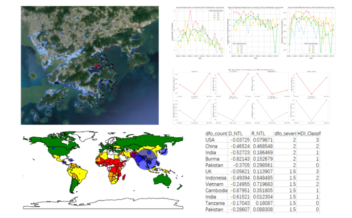
Urban flooding increasingly threatens megacities, especially in low-income countries. Despite the gravity of the issue, most flood risk studies have predominantly focused on high-income regions like the European Union and the U.S., leaving developing nations relatively under-examined.
Many of these studies hinge on census data combined with land cover information, relying on results from flood inundation models that have inherent uncertainties. Moreover, the majority of research has a localized focus, often overlooking broader patterns that could emerge from comparing cities at different developmental stages.
However, the advent of the Defense Meteorological Satellite Program’s Operational Linescan System (DMSP-OLS) provides a promising avenue for a more comprehensive analysis. By utilizing this nighttime light data with flood sensitivity mapping, this study aims to fill the research gaps, offering insights into the flood risks facing megacities across various development levels.high-frequency and high-resolution data enables continuous monitoring and precise assessment of wildfire impacts.
Zongrong(Jasper) Li
Student at USC
My research interests include GeoAI, Urban Informatics and Spatial Data Fusion.